Loved by workers
An awesome user experience that teams actually adopt
The FORMATION app is designed for the people who use it every day. It opens instantly on any phone, feels familiar, and keeps work simple.
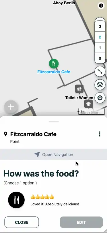
Scan QR Codes to interact with things around you. Identify assets, update their metadata, attach a photo, leave a comment. Search for what you need, and navigate to where you are needed with indoor navigation software. No training, no app installs, just a Map-first experience workers enjoy.
- Map-first user experience that feels like a modern consumer app.
- QR Code entry points for instant access.
- Search and indoor navigation software that work indoors and outdoors.

World to floor
Zoom from global context down to a single room
The FORMATION Map is a continuous spatial model. You can start at world view, zoom into a campus, drill into a building, and move across floors without losing context.
- Zoom from world view to floor level in one continuous Map.
- Outdoor areas, buildings, corridors, and rooms in the same spatial system.
- Switch between floors without losing your position.
See live asset movement
Real-time positions on the Map
Watch assets move across sites as locations update in real time. FORMATION is an asset tracking platform where Hybrid Tracking blends Passive Tracking and Active Tracking for hybrid indoor outdoor tracking without replacing your existing tools.
- Live positions and last-seen status on the Map.
- Use RTLS where you need precision, QR Codes where you need speed.
- Follow movement across buildings, floors, and outdoor zones.

Search & Navigation
Find people, assets, and places in seconds
Search is the fastest way into the Map. Type a room, asset, or label and get instant results. Navigation then gives people a clear path through buildings and across sites.
- Search across assets, rooms, and Map Markers.
- Navigation works indoors and outdoors, no positioning hardware required.
- Routes update as your Map evolves.

Process Insights and Optimizations
Expose bottlenecks and utilization gaps
Dashboards, heatmaps, and path analysis help teams see where flow breaks down and where capacity is wasted.
- Heatmaps reveal congestion and under-used areas.
- Path analysis reconstructs how work actually moves.
- Dashboards align operators and management on the same reality.

QR Code workflows
Instant access at the point of work
QR Codes connect the physical world to the FORMATION Map. This QR Code tracking system lets teams scan to open the Map where they are, report issues, or trigger tasks without leaving the workflow.
- Open the Map instantly from signage or assets.
- Create issues, feedback, or tasks with a single scan.
- Works without app installs or special hardware.

Integrate & extend
Connect ERP, MES, and IoT
FORMATION integrates with existing systems and data sources to avoid rip-and-replace. Sync locations, status updates, and sensor data through the API and Agent.
- Connect Omlox, MQTT, and other IoT brokers.
- Update objects on the Map with metadata and sensor readings.
- Export data into BI tools for deeper analysis.
Go deeper on the Map
Technical deep dives and background reading